|
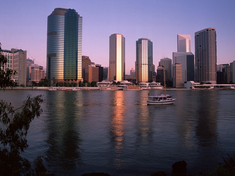
All About BrisbaneBrisbane (affectionately known as "Brissy") is the capital and largest city of the state of Queensland in the north-east of Australia. It had an estimated resident population in 2013 of 2.24 million, according to the Australian Bureau of Statistics and covered an area of 5,950 km². Queensland (the Sunshine State) is the 2nd largest state in Australia occupying some 1,727,000 km² (nearly a quarter of the total surface area of Australia). Brisbane is the third largest city in Australia (only Sydney and Melbourne have larger populations) and it is officially Australia's fastest growing city. The population is expected to more than double in the next 50 years. The population is also culturally quite diverse. Currently over twenty-six percent of Brisbane's population was born overseas. In 1996 over fifteen percent of the population spoke a language other than English at home with Cantonese, Italian, Vietnamese, Mandarin, Greek, Spanish, German, Tagalog (Filipino), Polish and Russian being some of the most commonly spoken languages. The Brisbane City Council website has more information about Brisbane's population in their Statistical Portrait of the Brisbane region.
The site on which Brisbane now stands was surveyed in 1823 by British explorer John Oxley. In 1824, the settlement of "Moreton Bay", a penal colony, was established where now the northern end of Victoria Bridge meets land. It was later renamed after Sir Thomas Brisbane, then governor of New South Wales. The convicts were removed in 1839 and Brisbane was opened for free settlement in 1842. In 1849, 700 British migrants settled in Fortitude Valley. Moreton Bay was then part of New South Wales, with a resident government, but in 1859, Queensland became a separate colony with Brisbane as its capital. At the first census in 1861, the population had grown to 6,051. After an economic crisis in 1866, the discovery of gold in Gympie in 1867 brought a new prosperity to the city and by 1881 Brisbane had 31,109 people. The City of Brisbane proper had a core population of 753,375 in 1991. Unlike other Australian cities, all local government activities are controlled by a single body, the Brisbane City Council. Voters elect a new council every three years using a system of compulsory preferential voting. Each ward returns one alderman and the whole city, effectively acting as a single electorate, elects the Lord Mayor. The municipality of the City of Brisbane, under the control of the Council, covers 1,220.49 km². This is distinct from the Brisbane statistical division, an area of about 5904.8 km² within which Brisbane's population is measured. The city of Brisbane is the largest area in the world controlled by a single city council. Brisbane Inner City Map Southeast Queensland Regional Map Info about Brisbane ACCESS Brisbane A guide to access and facilities for people with disabilities Beerburrum and Beerwah State Forest Historical Images of Brisbane (new) Australian animals (new) Some cameras around Brisbane (new) A freak hailstorm 19th May 2005 128 km Brisbane (Mt Stapylton) Weather Radar (new) e-mail me with suggestions Please note that some images on this page are used without the express permission of any owner or copyright holder. If you own these images and wish to grant permission or do not want me to use them please contact me. Last modified: 3rd June 2010 |